For all you nosey people wanting to know what B and K (and now the Ripster) are up to, this page is for you.
Showing posts with label Guam. Show all posts
Monday, October 29, 2012
Wednesday, October 24, 2012
Guam weather
All in the span of an hour or so. This is the view from my desk that I'll be losing in just a few days. I'll miss it. I love how the presence of the sun brings so much color to the world.
Thursday, September 27, 2012
We're moving to the zeach
Well, we lost the pink beach apartment. So we're moving to the zeach instead. The beach-front apartment adjacent to the zoo that I was a bit wary of several weeks ago. It actually turns out the word I thought I coined to describe the strange placement of my new home is already a snowboarding term, formed from the compression of Zach Leach's names. I wonder how often that happens to people? There are only so many combinations of letters in our alphabet, after all, and no, I am NOT going to attempt that math.
After much anxiety over the decision to live next to a hotbed of perceived tropical diseases just waiting to jump from monkey to human over the fence outside our window, and much anticipation over whether or not we were selected to move in over several other potentially interested people, we will very soon be proud residents of the Blue Lagoon condos. While I don't expect any visits from Brooke Shields, we aren't all that far from a Hooters, and several other points of interest, namely a yummy sushi joint, the largest K-Mart in the world (supposedly, though Wikipedia's source for that factoid is a Guam tourism portal), and a high school I've been wanting to go scout out.
I'm not really excited about packing, as previously noted, but at least we don't have to schlep things too far. We only need to move from point A to point B, or about 1.4 miles.
I was also initially worried about living on the beach, what with typhoons and tsunamis being real things here, but we've got a little heft to the building, no thatched roofs or anything, so I'm starting to get excited. We sort of figured, if we're going to live on an island, we should feel like we're living on an island. This place does just that. Here's our beach, and a view of our building. All those trees are hiding the zoo.
These are the southwest and northeast views of Tumon Bay.
The best things about this place are that Ripley is going to get tons more exercise, and K and I are hopefully going to spend more time outside our house. Since we'll be that much closer to the busy hotel row with its shops and restaurants, and "winter" is on its way (so the temperature might drop down to the low 80s more regularly), I hope this will mean more time outside and more exercise for us too. Indoor photos forthcoming once we move sometime at the end of October.
Tuesday, September 11, 2012
We hope we're moving here
I know what you're thinking. "Bethany, you just moved to Guam. For heaven's sake, why are you moving again?"
As sane people, you ask very astute questions. Why, indeed, would we want to move again? I could tell you, but then I'd have to kill you. And all of the people on the internet. Suffice it to say our lease is up at our current place so the band is breaking up. The good news is we'll be moving into a more private place, and hopefully this will help Ripley's separation anxiety since there will be fewer people for her to separate from on a daily basis.
K and I have been hunting for a new place for a couple weeks, and have gotten really close to sealing a deal on some new digs. We've been able to work out a less than one-year lease, have negotiated having a dog, and have offered $500/mo under the listed price for the place. The owner seems amenable to all these conditions. The place has a new kitchen, lots of open space, and has a great view. I'm wondering what's wrong with it that no one's snapped it up before now, but I guess we'll find out. We should be moving in a month or so.
![]() |
| Left |
![]() |
| Middle |
![]() |
| Right |
We decided to NOT go with the place that was directly ON the beach since it overlooked the zoo. Not kidding. We could hear monkeys and stuff from the balcony. OOG.
This is the view from the WiFi enabled cafe that's right across the street from our hopefully new place. You can actually see the cafe in the left shot and right on the left edge of the middle shot above.
![]() |
| Tu Re Cafe porch |
Hooray for Apple forums.
Saturday, August 18, 2012
A peek at some of Guam's wildlife
When I was a
kid, I loved reading books about animals, and I can remember going to
the animal section of my elementary school library repeatedly. I loved
the nonfiction stuff too. Read them all. But that nonfiction science
thing can be funny. I went through a dinosaur phase and learned all
about the terrible lizards, including the "thunder lizards" or
brontosauruses (brontosauri?),
only to find out about two years ago at an exhibit in the Lawrence Hall of Science that they never really existed. It was sort of like learning that Pluto had been demoted.
As a scientist, I appreciate the process and progress. As we learn
more and more about the world around us, we make more predictions, test
them, and revise our theories in order to be consistent with our
evidence.
![]() |
| Things like this make me sad. |
This
year, I'm on a quest for a friend that may take the entire time I'm
here to complete. There is a seemingly mythical creature called the
blue-tailed skink (and I've just learned that only the juveniles and
females have blue tails, missy, so you're not making it easy for me)
that has been declining in numbers for the past few decades on Guam
because of an invasive species called - no, NOT the brown tree snake -
the curious skink. As its name suggests, these "curious" critters are
more likely to be seen than the one I'm looking for because they're
bold. I'm sure I've seen bazillions of them. The quest continues, and I
never leave home without a camera. And I will NOT post someone else's pictures of these critters as a matter of pride.
And speaking of snakes, this is my only evidence of brown tree snakes on the island so far:
At least, I'm assuming this used to be a brown tree snake. Sort
of sad. I've also learned, through my skink research, that these snakes
used to be noctural, but have been adapting to their changing food
supply options and have become more diurnal as evidenced by records of snake-induced power outages.
The island is losing millions of dollars every year because of these
outages, hence the traps. I saw this trap on Cocos Island, a teeny tiny
island off the southern tip of Guam, last Christmastime.
While
there aren't many street signs in this place, as previously mentioned, I
did stumble upon a sign for - I kid you not - Sesame St. before my
always-carry-a-camera rule was established. (I may come back and update
this post if I ever make it out there again.) I've even seen some
characters from the show here on Guam too. This is Grover, who lives in
a local pet store and appears to have a bad reputation.
I
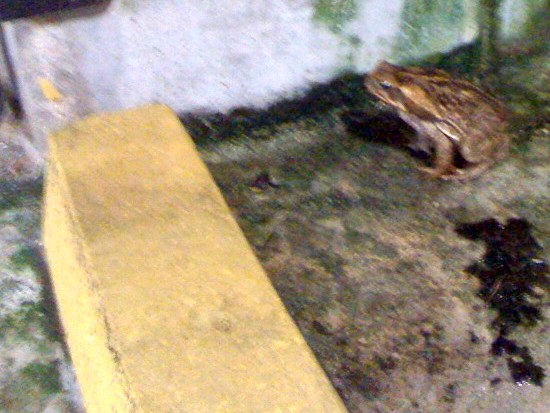
also found one of Kermit's friends in the garage under our house. The
yellow is a parking space curb for size comparisons. It was dark, so
the shot's a little blurry.
This critter was my welcome wagon and was in the driveway the first day I arrived on Guam. This is a coconut crab from front and back, but a good distance away. I
was not brave enough for a size comparison shot, though it was about as wide as a volleyball. These things are
creepy since they remind me of spiders, and some other things I've previously posted about.
Perhaps the craziest animal I've seen so far is the dog that rides the carabao
[pronounced not like caribou (car-i-boo), but bow as in "take a bow"
(car-a-bow)]. Both this dog and owner should do just that for being
able to do this great trick. I've seen this threesome walking down the
side of the road on several occasions, but I'm always driving so can't
snap my own picture. I lifted the one below from another
woman's blog - click the image to check it out. The other carabao posed
for me and offered me a ride on Liberation Day
last summer. (I'll have to comment more on this holiday at some point
in the future. That's a whole other ball of wax, as they say.)
Perhaps you're familiar with NYC's Cow Parade
that happened in 2000. I'm not sure why I saw some of these cows in
person, but I remember seeing them so must have been in Manhattan that
year. Well Guam has something similar - and there are painted carabaos
(not sure if it's right, but I vote for the plural of carabao to be
carabao) all over the island too. These are the only two I've captured
so far.
Calvo's happens to be my car insurance company. I have typhoon insurance on my car, so really like this statue.
Finally,
to round out this post let's look at two examples of some aquatic
wildlife. I found this on last weekend's dive at a site called
Fishbowl, which disappointingly did not live up to its name. We had an
annoying current that kept us working hard to not crash into the coral
and didn't really see many critters. The first time I saw this eely
thing from a distance I thought it was a piece of rope that had been
lost from a boat or something. Only after being right on top of it did I
realize it was actually alive, and sort of ugly.
In
case you can't quite tell, it's pushing the sand into what I can only
assume to be its mouth with those tentacle-like protrusions. I'm still
not quite sure what this wormy/snakey thing is after looking online, but
if anyone out there knows, please leave a comment.
And
finally, in honor of Shark Week, this is Ripley's impersonation.
Imagine a fin on her head, and she's quite scary. Otherwise, try not to
drown from laughing. She was attempting to "save" her owner, because K
sat down in the two feet of water she'd just been standing in and
freaked the dog out.
Labels:
blue-tailed skink,
brontosaurus,
brown tree snake,
carabao,
coconut crab,
Cocos Island,
Guam,
Lawrence Hall of Science,
Liberation Day,
NYC Cow Parade,
Pluto,
power outages,
Sesame St.,
wildlife
Friday, August 17, 2012
Bay Area representing in Guam
Saturday, August 11, 2012
The only white dude on Guam running for office
Sunday, July 29, 2012
Guam cartography
One of my first tasks upon arriving in Guam was to get my dog, Ripley, out of
quarantine. She was being kept at the Harper Valley Kennels (HVK), somewhere
on the island, but since they carted her from the airport directly to
their site, I had no idea where to get her. HVK's website provides this
map to help you
find them:
Seriously?
I mean, why bother? No streets are labeled, there's no address for the
kennel, and the exact location has been added in by some non-Google-map
entity, though this is clearly a Google map. Google maps, in
conjunction with GPS
technology on my iPhone, are my mainstay of
navigation back home. They let a blue dot in my palm tell me exactly
where I am at any point in time and tell me how to find any location
worth going to. Sadly, Google maps are next to useless on Guam because
not much has a real street address, or Google can't find it. (Don't
even think about using the little yellow guy.)
After some searching, I found HVK's address on their website, entered it into Google maps, and was shown another location entirely. So I called them to figure out where I was supposed to go. I was told to come to their Hagatna address (their vet location) so they could give me a map to their kennel location in Chalan Pago. I considered that they would give me the same map they had online, and also wondered why if they had a better map, why that one wasn't online? But asking would waste time, and I just wanted to rescue my dog.
Instead I asked where the vet office was and how to get there. Studies have shown that women are more likely to give directions by referencing landmarks, whereas men are more likely to use cardinal directions and distances to travel. Guamanians, regardless of gender, tend to tell you where something is using a few large buildings as landmarks, which is challenging for a noob to the island. I was told by the dude on the phone that "a good landmark is the Yamaha building - we're on the second floor." This was great information, had I already known where the Yamaha building was. (Internally: I need to know how to GET to where you are, not where you are!) Luckily there's one main drag that goes around the island, and I knew how to get to Hagatna. Driving nice and slowly, I eventually found the Yamaha building, and went upstairs to get my map.
After some searching, I found HVK's address on their website, entered it into Google maps, and was shown another location entirely. So I called them to figure out where I was supposed to go. I was told to come to their Hagatna address (their vet location) so they could give me a map to their kennel location in Chalan Pago. I considered that they would give me the same map they had online, and also wondered why if they had a better map, why that one wasn't online? But asking would waste time, and I just wanted to rescue my dog.
Instead I asked where the vet office was and how to get there. Studies have shown that women are more likely to give directions by referencing landmarks, whereas men are more likely to use cardinal directions and distances to travel. Guamanians, regardless of gender, tend to tell you where something is using a few large buildings as landmarks, which is challenging for a noob to the island. I was told by the dude on the phone that "a good landmark is the Yamaha building - we're on the second floor." This was great information, had I already known where the Yamaha building was. (Internally: I need to know how to GET to where you are, not where you are!) Luckily there's one main drag that goes around the island, and I knew how to get to Hagatna. Driving nice and slowly, I eventually found the Yamaha building, and went upstairs to get my map.
Now
conventions make the world go 'round, and there are countless ones we
all agree to (some of them unconsciously) in order to maintain some
level of consistency or to keep communication clear. Some conventions
make perfect sense, like using the metric system for measurement. (Come
on, America, get on board this ship.) Sometimes they make no
sense at all, like calling the direction that current flows through a
wire the direction that positive charges move, when it's really
negatively charged electrons doing the moving (in the other direction).
Silly physicists. Much to the chagrin of
my students year after year, many of our science conventions are so
well-entrenched that it's harder to change them than it is to train
people to do things in a counterintuitive way. Sorry, kids. You'll get
over it, just like I'll figure Guam out eventually...
Cartography,
the art/science of making maps, has been around for thousands of years,
but I
was apparently mistaken in thinking (what I perceived as) the largely
universal conventions used when drawing maps would be followed here on
Guam. These are the basic things that I've grown accustomed to expect
of any map, unless otherwise indicated:
It took the woman at HVK five minutes to explain this map. I think she wasn't sure I knew to follow the roads, so she drew in some great clarifying arrows for me. And can I just say, if it takes five minutes to explain a map, it needs more detail. Just saying. She also gave me some landmarks to look for (note the Shell and 76 gas stations written in), but true to my study's findings, she neglected to indicate any distances.
- The map should attempt to represent as accurately as possible the terrain you're trying to navigate. This is how you can recognize where you are and figure out where you need to go.
- Scale will be incorportated into the map, thereby giving an estimate of how long it'll take you to get from here to there.
- If there's no compass rose shown, the top of the map is north. Of course this is a Northern Hemisphere-centric perspective on the world. I love maps with Australia on the top and at the center. Either is fine, just let me know which end is "up" and I can orient myself. (The enemy's gate is always down.)
It took the woman at HVK five minutes to explain this map. I think she wasn't sure I knew to follow the roads, so she drew in some great clarifying arrows for me. And can I just say, if it takes five minutes to explain a map, it needs more detail. Just saying. She also gave me some landmarks to look for (note the Shell and 76 gas stations written in), but true to my study's findings, she neglected to indicate any distances.
After she was done giving me "directions," I asked, "So how far is it from here to the Department of Agriculture?"
It looks like it's a large city block away, right? She just looked at me for what seemed like a long time, so the teacher in me offered some leading questions.
"Is it like five minutes? Ten minutes?"
After a sigh, an eyeroll of annoyance, and some thought, she claimed it'd be about 15 minutes with traffic. While it took me about 7 minutes to get there, I began to get quite concerned after driving not very far when my mental image of the route I'd be taking based on the low tech model in my palm was very different from the path I was taking, even though I was carefully staying on the roads with the arrows. Take a look at what this map should have attempted to approximate:
It looks like it's a large city block away, right? She just looked at me for what seemed like a long time, so the teacher in me offered some leading questions.
"Is it like five minutes? Ten minutes?"
After a sigh, an eyeroll of annoyance, and some thought, she claimed it'd be about 15 minutes with traffic. While it took me about 7 minutes to get there, I began to get quite concerned after driving not very far when my mental image of the route I'd be taking based on the low tech model in my palm was very different from the path I was taking, even though I was carefully staying on the roads with the arrows. Take a look at what this map should have attempted to approximate:
(click to zoom)
I just had to look this up after I got home. I especially love that routes 8 and 4 on the sketch seem to parallel each other, while for most of their lengths they're actually close to perpendicular. (I also can't believe how many schools there are on the island. This is just one tiny section of it!)
After
going to the Department of Agriculture to get Ripley's release
paperwork, I had a lunch date with K to keep before picking up the
pooch. I figured I'd continue to follow the map and hang a right at
route 4 to get me back to the main drag to pick up my date. With all
the hidden twists and turns I had no idea of at the time, and no
landmarks but jungle around me, I eventually just started following
signs back to Hagatna since I figured the island isn't that big. When I
could see the ocean in the distance I begain to relax because I could
reorient myself. I had just a brief moment of concern when I thought
about coming out on the other side of the island - after all, the ocean's everywhere out there - but I quickly reclaimed my confidence.
After
lunch it took another hour to find the right road to the kennel using
my map. Luckily I have a lot of time here. On the bright side, I did
find both the University of Guam and Guam Community College while
meandering around off the beaten path of Marine Corps Drive (route 1).
Maybe I'll drum up some tutoring gigs out there. I'm sure there are
some Guamanians struggling with chemistry conventions that seem just as
crazy to me as Guamanian navigation methods.
Ripley's first rude awakening
When it rains on Guam, there's not really any warning - or build up. The sky just opens up and it pours. You're soaked through in just a few moments, so there's really no reason to bother running for shelter. You won't be any drier once you reach it than if you had just walked casually, but you will be hotter from exerting yourself in the heat.
My dog is not aware enough to realize this, however, and she hates the rain. So this morning when she was dry one moment and getting drenched the next, her brain sort of short circuited. I can't remember the last time I laughed as hard as I did watching her try to shake, run, and look back at me all at the same time trying to figure out why I wasn't moving faster.
Ripley, the moral of the story is be less picky about where you do your doggie business so you can stay close to the car.
Wednesday, August 03, 2011
Dives, Dives, Dives
These are some pictures from the Tokai Maru and Cormoran wrecks - you can touch both of them at about 94 ft, though it's too dark to get a picture of me doing so with my camera. I tried.
Up close and personal
Kerriann near the Tokai
K in the smokestack of the Tokai
Fish grazing on the side of the boat
B and K during the "Wreck Diver's Special"
Vecky's Reef drift
Kerriann plays with a huge sea cucumber
The video and photo slideshow below are combinations of footage taken from several dive sites, including the wrecks mentioned above, Vecky's Reef, Fisheye, Gab Gab 2 (where the large fish are), and the reef in front of the Hilton Hotel. Unfortunately I have no evidence of either of our dives to the American Tanker wreck, though it was definitely worth documenting. My camera batteries weren't cooperative. Next time.
Sometimes video works better than stills, sometimes it's the other way around. There's so much to say about all these dives, but school is starting soon, I've taken forever as it is to get these posted, and pictures are worth thousands of words, right? Video must be worth billions. Enjoy. I'm still working to increase the resolution. I lost an incredible amount by compressing the file so I can stream it online...
I picked a random piece of music from my iTunes library that was about as long as the video. There are some funny dramatic sound/image coincidences that happened completely by chance.
Sunday, July 17, 2011
Advanced Open Water Certification - Check!
Kerriann and I finished our advanced class yesterday, so are now able to go on some of the deeper dives in the area. I'm pretty excited, though diving five dives in less than 48 hours is too tiring for us noobs.
Highlights of my dives from the advanced class:
San Luis Beach (Night Dive) Friday, July 15, 2011 ~7 PM
I did this dive without K, as she had some other more...interesting things to do that evening.
American Tanker (Wreck Dive) Saturday, July 16, 2011 ~2:30 PM
This was a boat dive in Apra Harbor in the Navy Base.
Finger Reef (Deep Dive) Saturday, July 16, 2011 ~4 PM
Second stop on the boat.
Clipper Landing (Navigation Dive) Sunday, July 17, 2011 ~2:30 PM
Gab Gab Beach (Multilevel Dive) Sunday, July 17, 2011 ~ 6 PM
(There wasn't a lot of new stuff to see on the last two dives as they were mostly about completing skills in the water.)
Note: All photos are still not mine, as I have not yet purchased a camera. Some were found on scubaguam.com, while others are my best approximation of what I saw from some pics found through Google image searches.
Highlights of my dives from the advanced class:
San Luis Beach (Night Dive) Friday, July 15, 2011 ~7 PM
I did this dive without K, as she had some other more...interesting things to do that evening.
- Huge (2 ft +) puffer fish hanging out behind a rock. While I've seen several of these of various sizes so far, I've never seen one puffed up.
- Elephant ear sponges, one about 3 ft in diameter.
- Black sea urchins about the size of a softball - moving around. I've always thought of these as sedentary, so it was really cool to see them moving along the coral.
- The full moon was out, and you could see it from a depth of 40 feet.
American Tanker (Wreck Dive) Saturday, July 16, 2011 ~2:30 PM
This was a boat dive in Apra Harbor in the Navy Base.
- Swam length of 300+ ft long tanker on the bottom of the harbor.
- Swam in a door and out through a hole in the roof of a small room on the stern of the tanker.
- Had to fight the urge to "right" myself in the water, as the tanker leans to the side.
- "Titanic" bow photo op.
Finger Reef (Deep Dive) Saturday, July 16, 2011 ~4 PM
Second stop on the boat.
- Deepest dive to date (97 ft) and essentially to the limits I'm now certified for.
- Geeked out on science and color changes at different depths due to red light not penetrating as deep as blue light.
- Sea turtles!
- Huge school of 12+ inch fish off in the distance - very spooky dark blob following us.
Clipper Landing (Navigation Dive) Sunday, July 17, 2011 ~2:30 PM
- Lost my buddy (Kerriann) during a navigation test with a compass since I swam too fast for her without checking that she was following (oops! won't do that again).
- Big confidence boost navigating the perimeter of a 10,000 sq. ft. section of reef alone using only a compass and ending up exactly where I started.
- Swam as shark bait for the entire dive as the knee that I injured getting into the water continued to bleed for over an hour in the ocean.
Gab Gab Beach (Multilevel Dive) Sunday, July 17, 2011 ~ 6 PM
- More turtles.
- Completed certification!
(There wasn't a lot of new stuff to see on the last two dives as they were mostly about completing skills in the water.)
Note: All photos are still not mine, as I have not yet purchased a camera. Some were found on scubaguam.com, while others are my best approximation of what I saw from some pics found through Google image searches.
Top 10 Reasons Guam's Speed Limit is 35 mph
10. No need to remember if the speed limit changed.9. Saves money through increased gas mileage.
8. Makes dodging boonie dogs and chickens easier.
7. Fewer serious accidents when drivers run red lights.
6. Reinforces the slow, island life mentality.
5. More time to find landmarks when following directions, as roads are not labeled.
4. No need to spend money on yellow advisory speed limit signs before sharp turns.
3. Visibility is unaffected when a torrential downpour starts out of nowhere.
2. Easier to take good side-of-the-road photos (e.g. dog riding a water buffalo).
1. Driving slow makes the island seem bigger.
Thanks for the inspiration, Mom!
Thursday, July 14, 2011
Typhoon Shmyphoon

In case you've heard about the tropical storm out here in the Pacific (I'm not sure if it's technically a typhoon or not), we're all doing fine here, though we have tons and tons of rain. It seems as though the storm is much north of us and is moving on to batter Japan, as if they haven't had enough problems already. I'm not sure how the diving this weekend is going to go yet. My class may not happen. We've got some flooding, small craft, and high surf advisories through the weekend, but as long as the storm keeps on its current track we shouldn't have any problems. I'll try to keep everyone posted.
Subscribe to:
Posts (Atom)